-
Pied à Terre
![Pied à Terre reisgidsen reisboeken]()

Reisboekenadvies op maat van uw personal shopper? Dat kan!
Bij Pied à Terre bij Scheltema is geen reis ons te ver: of u nu gaat wandelen in de Schotse Hooglanden of alvast droomt over een lange wereldreis, met het grootste assortiment van Nederland geven wij u graag een passend reisboekenadvies op maat. We denken met u mee en zoeken de beste gidsen en kaarten voor u uit. Want het plezier van een mooie reis begint al in de voorbereiding. Hoe werken we? Stuur ons een e-mail met uw reisbestemming. Wij verzamelen de beste gidsen en kaarten en plannen een moment met u in, zodat u ze in alle rust kunt komen bekijken. Geselecteerd door uw eigen Personal Shopper. En uw avontuur kan beginnen! Tot snel ziens bij Pied à Terre bij Scheltema!
Dit is Ursula, uw personal shopper
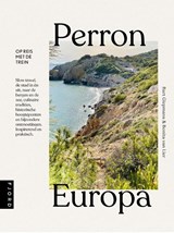
Perron Europa
Perron Europa - treinreizen Europa
Bart Giepmans ; Bonita van Lier ; Gerdien Barnard ; Bonnie Joosten
Op reis met de trein Met 250 duizend kilometer aan spoorlijnen is geen ander continent zo goed ontsloten als Europa. Onthaasting? Iedereen snakt ernaar en slow travel is bijna een modieus begrip. Maar hoe voelt het daadwerkelijk, dat andere reistempo? De auteurs stapten in de trein en namen alle tijd. Zo zagen ze landschappen in elkaar overgaan, culturen zich ontrafelen en ontdekten ze het unieke karakter van Europa. Van de rozerode midzomernacht in Zweeds Lapland tot de wijnstokken op de hellingen van vulkaan Etna en de scherpe pieken van het Tatragebergte.
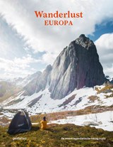
Wanderlust - Europa
Wanderlust - Europa
Gestalten
Wanderlust: Europa bevat de meest legendarische hikes en wandelingen van Europa. Van de spectaculaire natuur van IJsland, door de uitgestrektheid van Zweden en het unieke landschap van de Baltische Staten tot de pareltjes van Georgië, Roemenië en Italië. In Wanderlust: Europa vind je korte en lange tochten die je voeren langs stranden, over heuvels en bergen en door vlaktes. In een prachtige uitvoering met de indrukwekkendste foto’s, duidelijke kaarten en heldere teksten. Voor wandelaars van alle niveaus.
Amsterdam, Reisgidsen & Fietskaarten
Fietskaarten, Wegenkaarten & Waterkaarten
 Fietskaarten
Op zoek naar een fietskaart voor uw fietstocht? Bekijk onze fietsgidsen en fietskaarten.
Meer informatie
 Wegenkaarten
Beleef meer met een wegenkaart. Start uw droomreis met een goede wegenkaart.
Meer informatie
 Waterkaarten
Blijf op koers met onze waterkaarten. Bij Pied à Terre vindt u uw waterkaart.
Meer informatie
Stadsplattegronden, Reisverhalen & Atlassen
 Stadsplattegronden
Verken uw favoriete stad. Wij hebben de (stads)plattegrond die u zoekt.
Meer informatie
 Reisverhalen
Zin om weg te dromen bij een mooi (reis)verhaal? Kom langs voor onze reisliteratuur.
Meer informatie
 Atlassen
Op zoek naar een atlas of historische kaart? Bestel het online of kom langs in de winkel.
Meer informatie
-
Personal Shopper
![Pied à Terre reisgidsen reisboeken]()


